H2Ohio and GLRI Projects
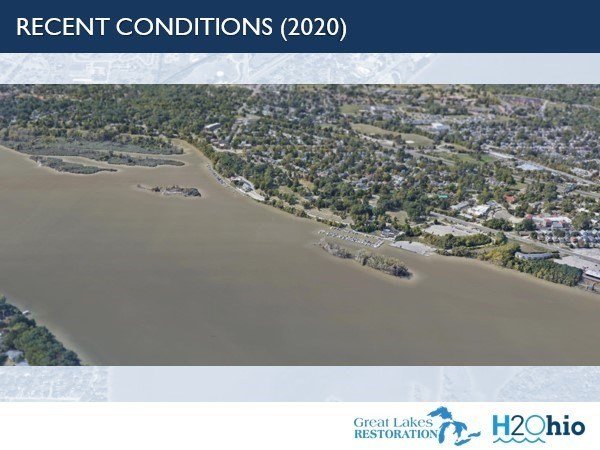
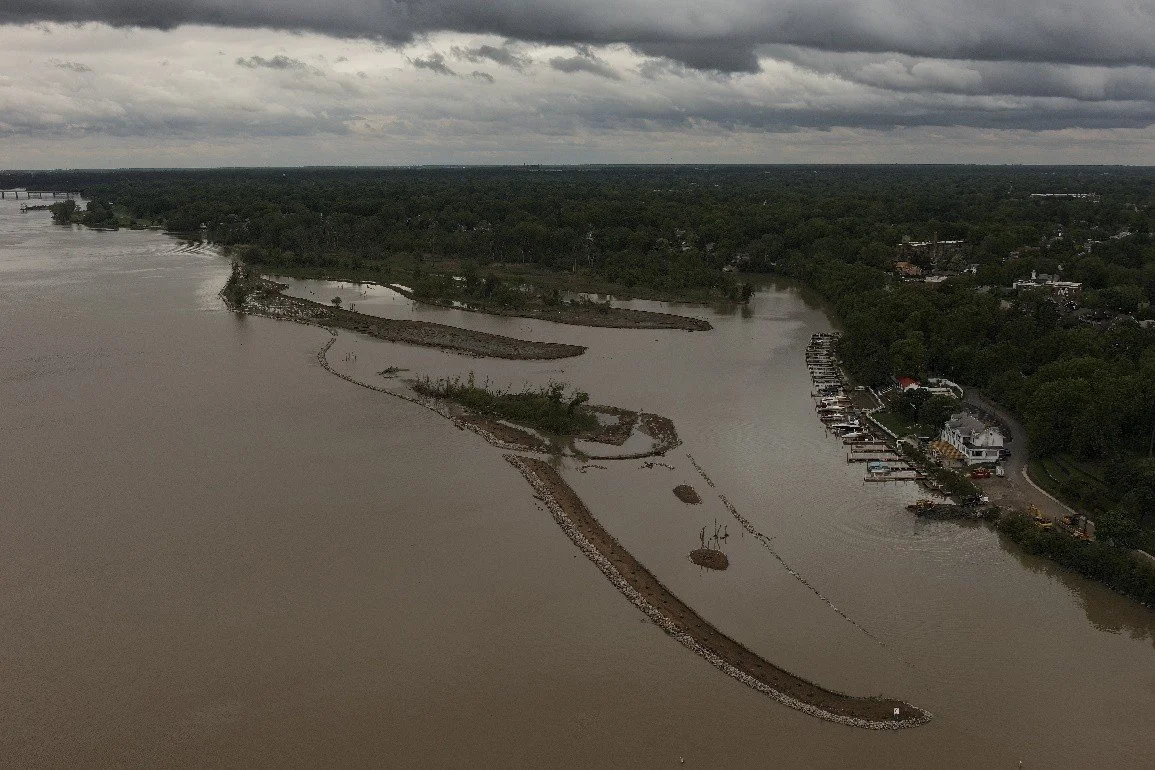
Clark and Delaware/Horseshoe Islands Restoration Projects
Click here to see monthly updates.
Construction of the Clark and Delaware/Horseshoe Islands Restoration Project is complete!
Mark Haynes Construction is the Toledo-Lucas County Port Authority’s construction contractor leading efforts to restore and protect these City of Toledo-owned islands in the Maumee River near Walbridge Park.
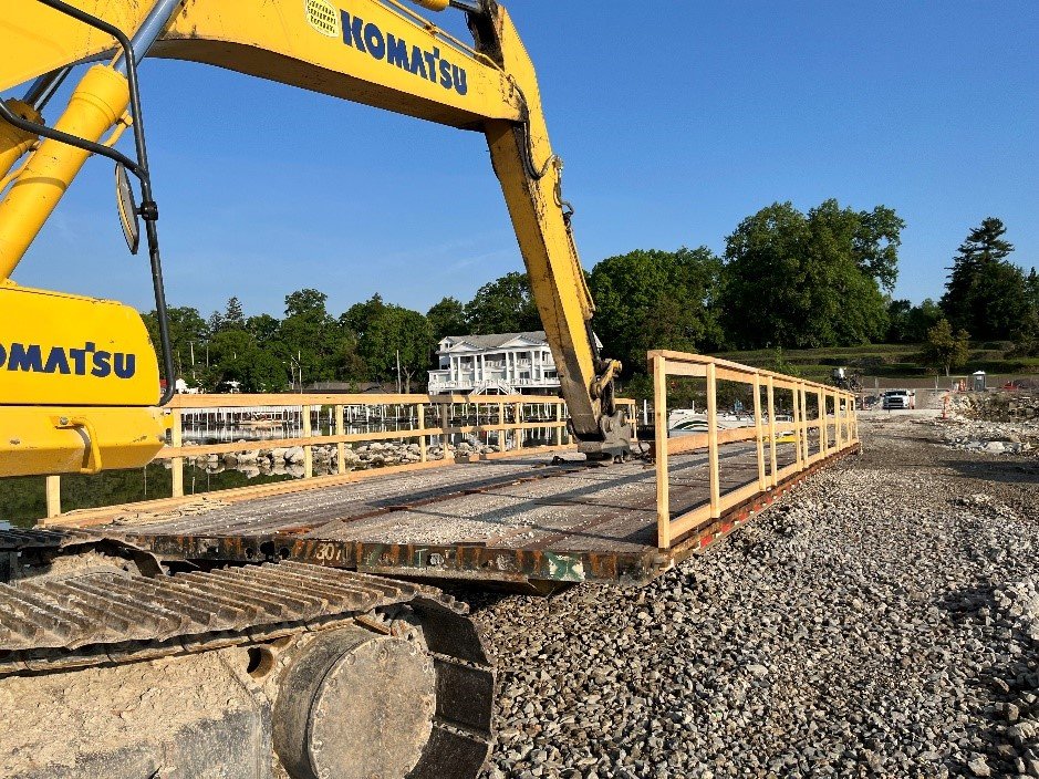
Staging areas were established for each of the two island areas: a gravel lot downstream from the Maumee River Yacht Club for work at the Delaware/Horseshoe Islands and the lower level of the public boat launch parking lot for work at Clark Island. Two temporary construction causeways were installed to connect the shoreline to the island areas to allow construction equipment to access the island improvement areas. They have culverts to allow for water flow and fish passage. The public is not allowed to use the causeways for any purpose. The causeways are anticipated to be fully removed by summer 2025.
All construction is currently scheduled for completion in fall 2025. The causeway to Delaware/Horseshoe Island has been removed so boater access to the deeper channel between Clark and Delaware/Horseshoe Islands is restored in this area. The causeway to Clark Island is is planned to be partially removed by the end of June and boaters using the public launch prior to this will need to follow an alternate path based on appropriate navigation charts (see the Notice to Boaters sign at the top of this page and at the public launch for the approximate alternate route).
The Toledo-Lucas County Port Authority is leading this effort in partnership with the City of Toledo, with significant input from the Ohio Department of Natural Resources (ODNR) and Ohio Environmental Protection Agency (Ohio EPA), and with support from the Maumee Area of Concern (AOC) Advisory Committee (MAAC).
The Port Authority received funding from the H2Ohio program and US EPA Great Lakes Restoration Initiative (GLRI) to complete this construction and the previous engineering, design, and permit preparation activities. While both projects offer nutrient reduction and habitat improvements, plans for H2Ohio-funded activities focused primarily on nutrient reduction through sediment settlement and plant uptake and GLRI-funded planning activities focused primarily on improving habitat for fish and benthos (small organisms that live on the river bottom).
The engineering, design, and construction planning activities were finalized in June 2023 and reflect significant stakeholder input gathered through discussions with more than 100 individuals during small meetings and public open house sessions. Plans were completed under the direction of the collaborating agencies and were led by engineers and scientists at Verdantas (formerly Hull & Associates, LLC), with input from several specialists, including modeling experts at LimnoTech and biologists at the University of Toledo.
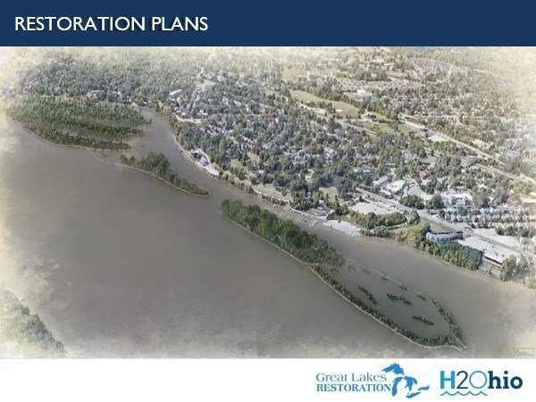
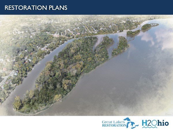
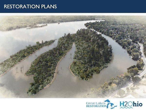
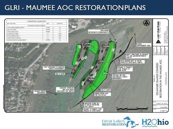
Details of Project Plans
The H2Ohio-funded project footprint includes the downstream portion of Delaware/Horseshoe Island and the entirety of Clark Island. This project restored 40% of the 1940s Clark Island footprint at 10.8 acres. The portion of the Delaware/Horseshoe Islands restoration within this H2Ohio footprint is 2.8 acres.
H2Ohio project features include:
Wetland Area
Open Backwater Area
Island Revetment
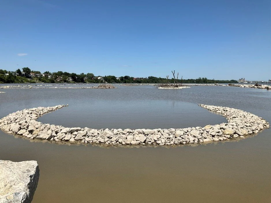
Inner Channel Reef
Breakwater/Backwater Islands
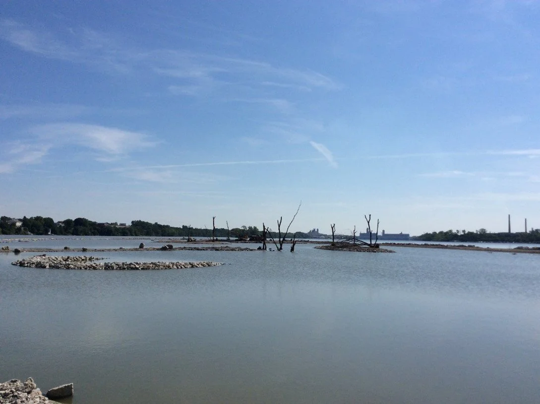
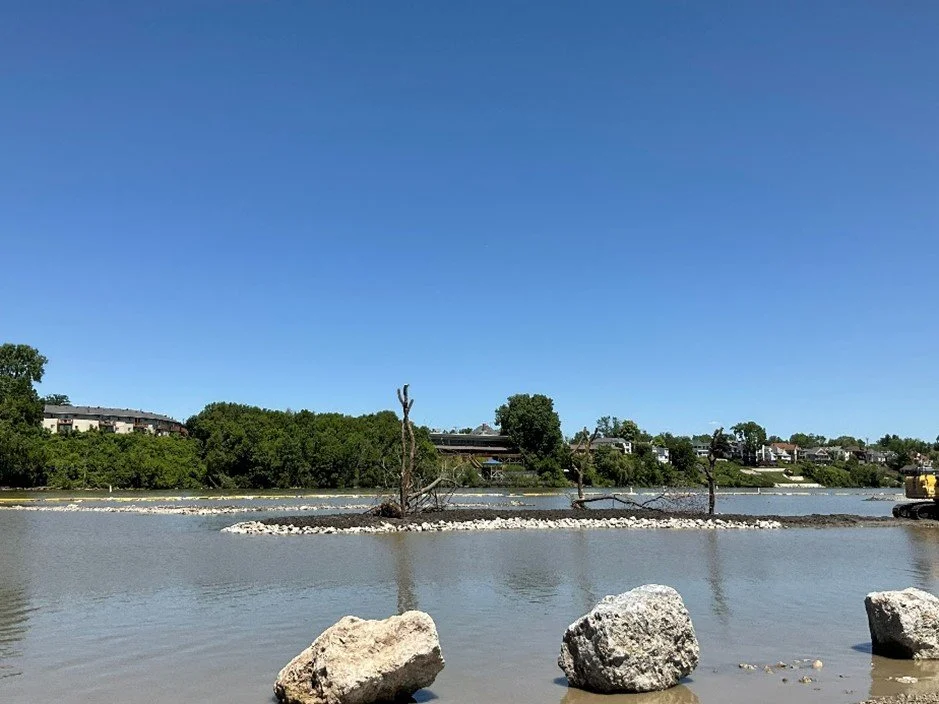
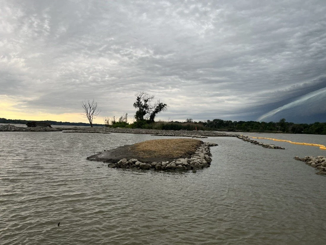
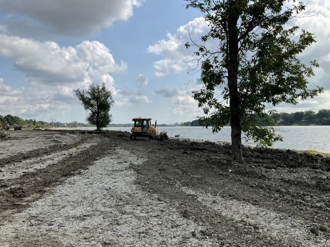
The restoration includes protecting and enhancing existing islands and restoring portions of the island footprints to provide significant nutrient reduction and water quality benefits while restoring important fish and wildlife habitat within the Maumee River. A portion of the original island footprint was restored and a rock revetment and inner channel reef were installed to protect the improved area from river flows, boat wakes, and ice scour. An interior, protected open water area was created to establish ideal conditions for sediment deposition. Small islands and stone and wood structures were installed in that area to provide important habitat in this system while slowing down water flows and promoting sediment settlement.
The GLRI-funded project, recommended through the MAAC, includes Delaware/Horseshoe Island. This project involves an approximately 50-acre improvement area with approximately 12 acres of regraded and enhanced wetlands and 33 acres where phragmites were removed/managed.
GLRI-MAAC project features include:
Wetland Area
Rock Barrier Reef/Eastern Island Revetment/Vegetated Stone Sill
Cove Improvements
Open Water Improvements/Enhancements
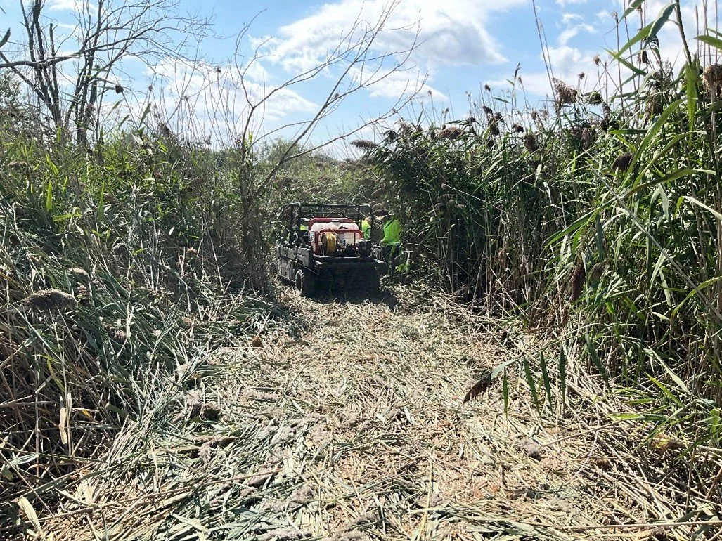
Invasive Species Management
More specifically, this project restored a portion of the original island footprint and improved habitat for fish and benthos, as well as enhanced upland wildlife habitat. An installed rock barrier reef/eastern island revetment/vegetated stone sill creates calm, open water habitat and provides protection from river flows, boat wakes, and ice scour. Coves were contoured with varying depths, providing areas with suitable habitat at different water levels. The installed wood/rock structures and added variety of gravel and other bottom substrate enhance fish and macroinvertebrate habitat. This project will also result in nutrient reduction through plant uptake and sediment settlement.
Planned Project Benefits
Reduced sedimentation and nutrient loading in the Maumee River and Lake Erie, resulting in water quality improvements
Improved habitat for fish, benthos, and other species
Protected and enhanced island and shoreline habitat that will:
Reduce further erosion of the islands
Create resilience in ecological systems to withstand higher and more variable river flows
Protect existing park and recreational boating infrastructure
Engineering Considerations and Details
Engineers and scientists on the project team spent considerable time analyzing current and potential conditions and designing durable and functional restoration plans. Some of these considerations and conclusions included:
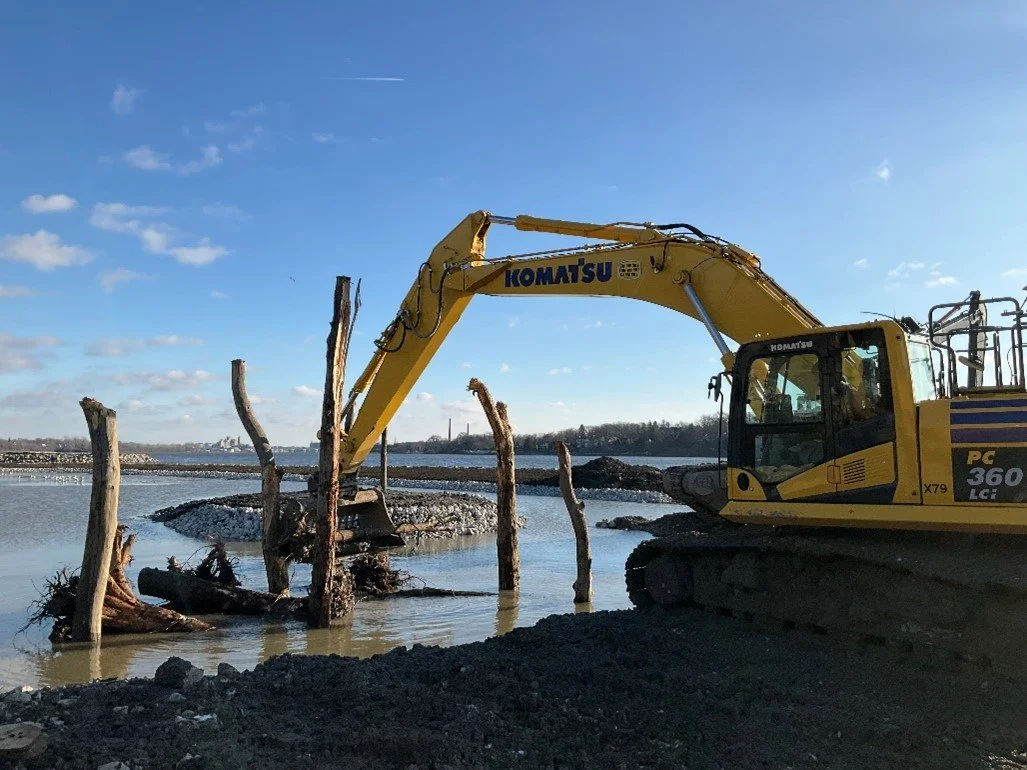
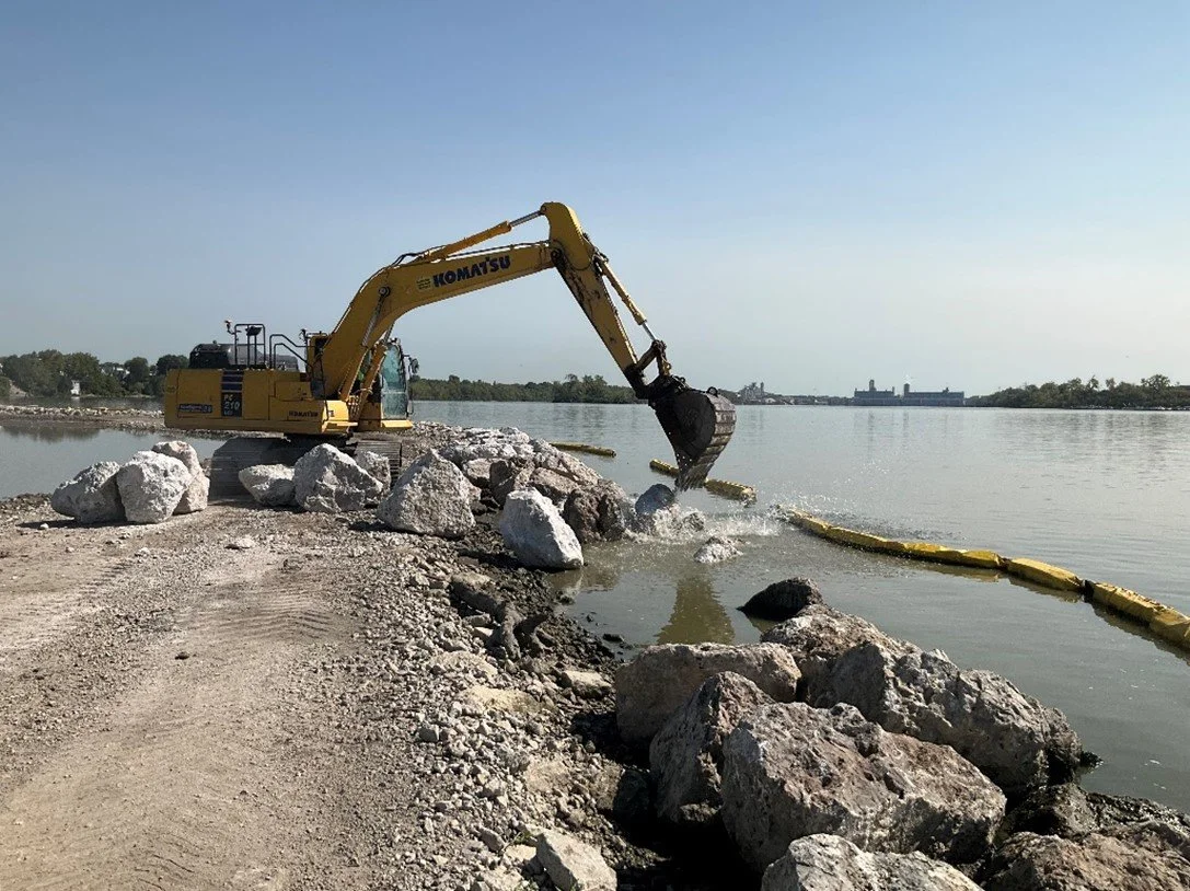
High Velocity Currents and Ice: It is well known that ice flows can be thick and destructive in the Maumee River. The design team included the revetment and reef structures in the plans to protect the islands from potential ice impacts. The modeling work and resulting design also considered high velocity currents during heavy precipitation and melting events. Project engineers specified the size of rock to withstand harsh conditions over the long-term based on standardized design methodologies.
Sources of Material: The contractor used rock from quarries in the region. All stone materials for the causeways were reused from the recently decommissioned I-75 (DiSalle) Bridge construction causeway. The fill material was made up of fines sorted from the I-75 (DiSalle) Bridge construction causeway and material dredged from the existing coves and open water areas at Delaware/Horseshoe Islands. The contractor also procured a variety of native vegetation (grasses, shrubs, and trees) that will continue to be planted on the islands over the next several months. Woody debris was also collected/procured from local sources.
Recreational Boating and Paddling Considerations
The temporary construction causeways were in place throughout the duration of construction. Through some creative solutions, the project team worked closely with users of the City of Toledo’s Walbridge Park public boat ramp, Toledo Sailing Club, and the Maumee River Yacht Club to establish plans and maintain boater access to the main river channel throughout the 2024 and the start of the 2025 boating seasons. Full boater access from both causeways is anticipated to be restored by the end of June 2025. In the interim, boaters using the Walbridge Park Boat Launch should continue to follow the downstream main channel access instructions . The project team ensured that all constructed improvements considered safe boating navigation and the existing navigation lights were realigned (by the city of Toledo) to reflect recent conditions (they had previously been out of alignment for years).
Post-construction, paddlers are allowed to enter into the protected open water areas of the islands but are asked not to traverse on the rocks or upland areas of the islands. The depths in the open water areas will vary based on lake levels and storm events, but generally are anticipated to range from one-foot to four-feet deep.
Maintenance
Restoration designs considered and prioritized improvements that will minimize long-term maintenance needs. As the owner of the islands, the City of Toledo will be responsible for maintaining the islands. They will follow the recommendations detailed in the long-term maintenance plans prepared during the engineering and design effort.
Supporting Studies
Recent biological assessments and other studies that support the need for this work include the 2019-2020 Identification of Optimal Sites for Maumee AOC Restoration Actions in the Lower Maumee River prepared by the University of Toledo and Bowling Green State University; the 2020-2021 Lower Maumee River Restoration Design Concepts prepared by the University of Toledo, Bowling Green State University, and Hull/Verdantas; and the 2021-2022 U.S. Army Corps of Engineers’ feasibility study entitled, Summary of Concepts at Selected Sites – Lower Maumee River Habitat Restoration Projects. Descriptions and links to all previously completed studies and reports are in the Lower Maumee River Pre-Feasibility Studies and Lower Maumee River Project Development Feasibility Study project summaries in the Maumee AOC DMDS program.
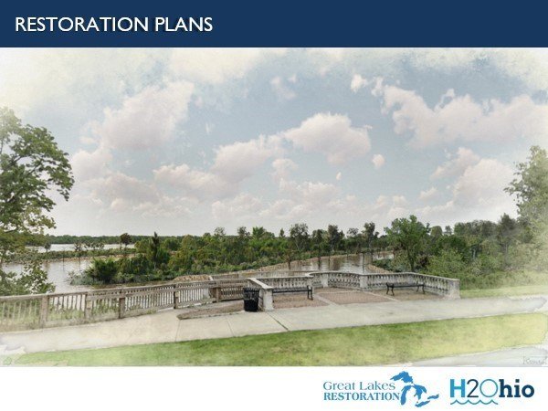
Please click here (PDF) to download the renderings.
Please click here (PDF) to view the construction schedule.
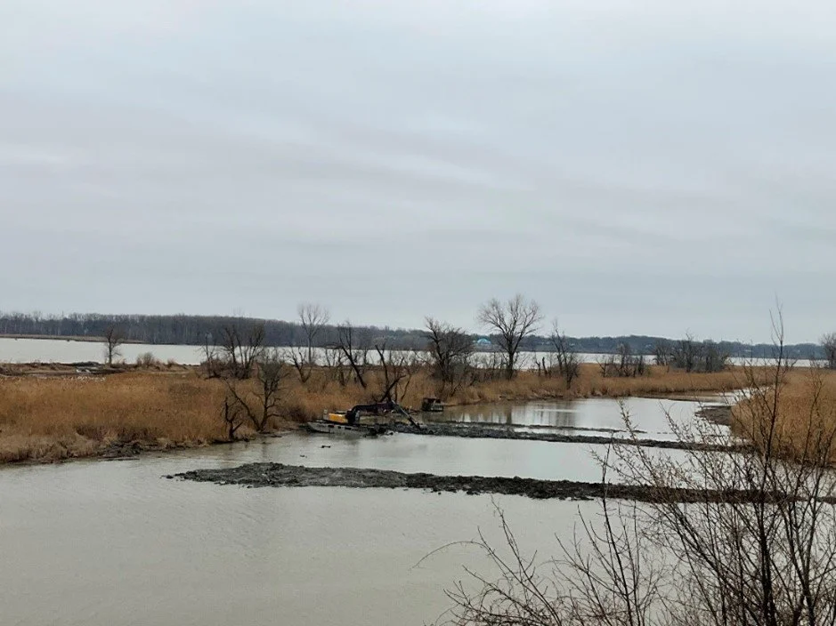
Construction of temporary access route and backfilling of wetland area along inner channel reef at Clark Island; facing southwest.
MONTHLY UPDATES
Overview of the new concrete (left) and concrete removal (right) at the parking lot entrance for the public boat launch; facing northeast.
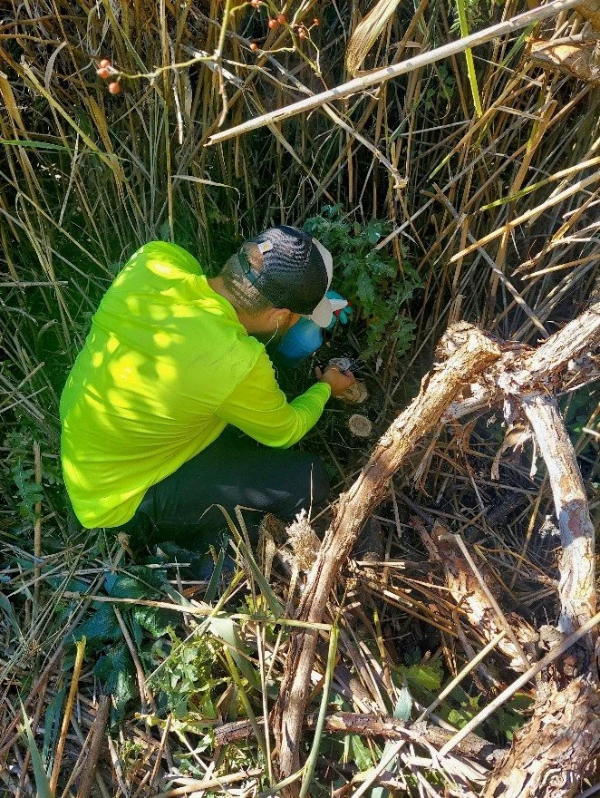
Treatment of woody invasive plant species at Delaware/Horseshoe Island (photo credit: GEI)

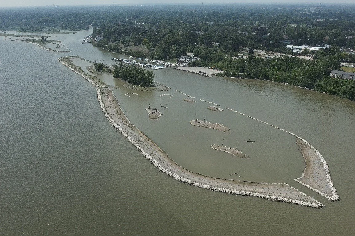
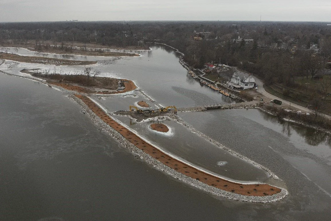
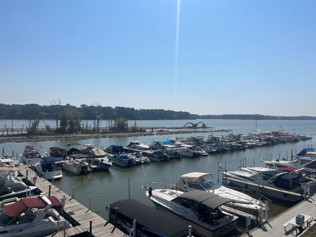
Overview of the downstream end of Delaware/Horseshoe Island; facing southwest.
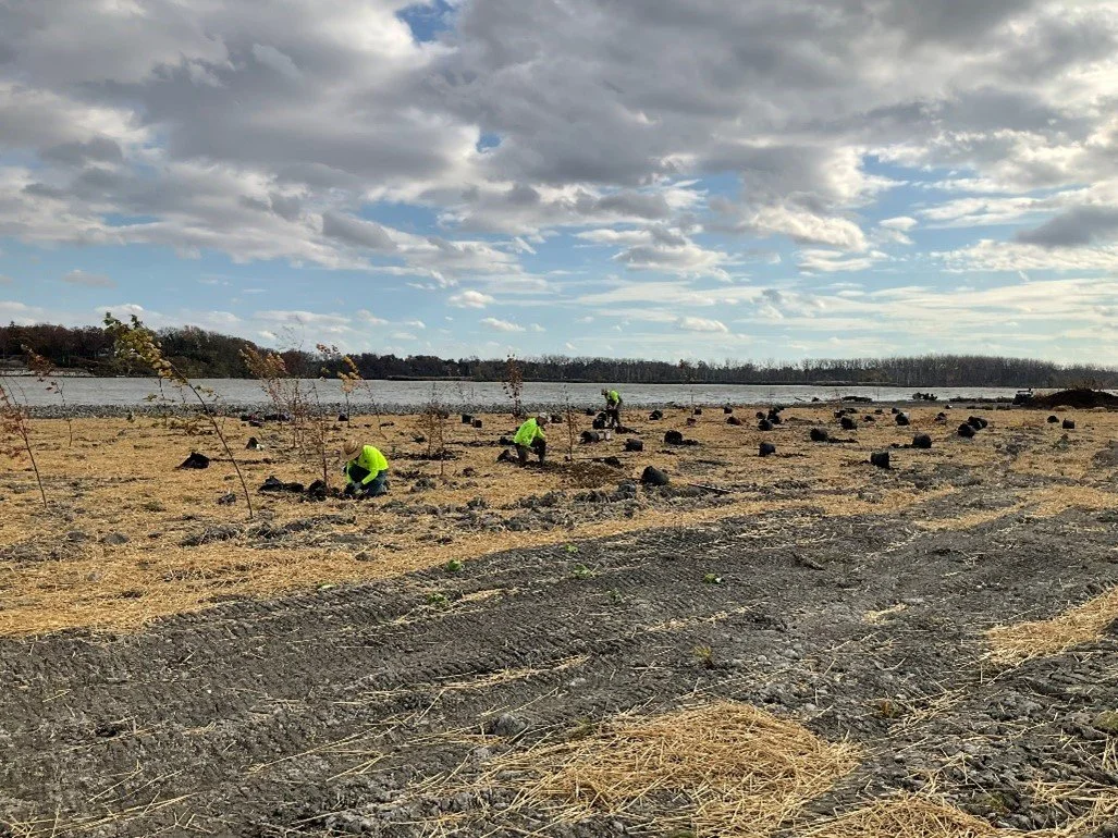
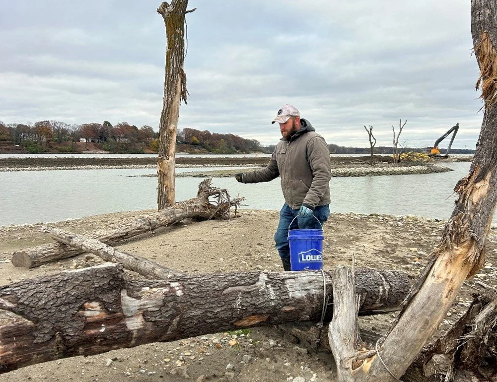
AUGUST 2025 - Mark Haynes Construction’s (MHC) landscaper, GEI, continued installing native plants at Clark and Delaware/Horseshoe Islands. GEI also continued to treat/manage invasive plant species at Delaware/Horseshoe Islands. Plantings and treatment/management of invasive plant species are anticipated to continue through fall 2025. MHC completed installation of the hazard signage at Clark and Delaware/Horseshoe Islands. MHC’s subcontractor, Geo. Gradel Co., mobilized to the site and initiated dredging of the channel from the Walbridge Park Boat Launch to the main river channel. This dredging is anticipated to continue through fall 2025. Dredging supports future operations and maintenance of the H2Ohio-funded portions of the project and boat access from the public boat launch between the two restored island areas to the main river channel. As stated in the previous update, earthwork activities are substantially complete at Clark and Delaware/Horseshoe Islands.
Overview of Clark Island; facing southwest.
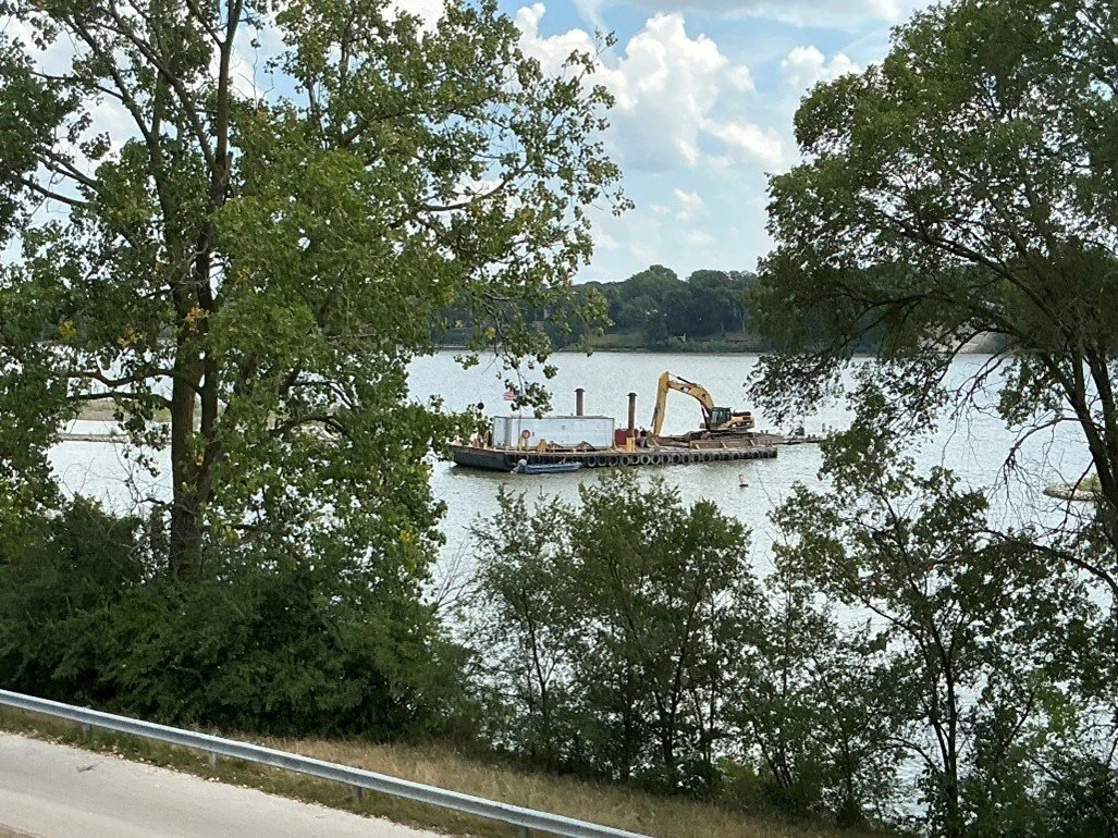
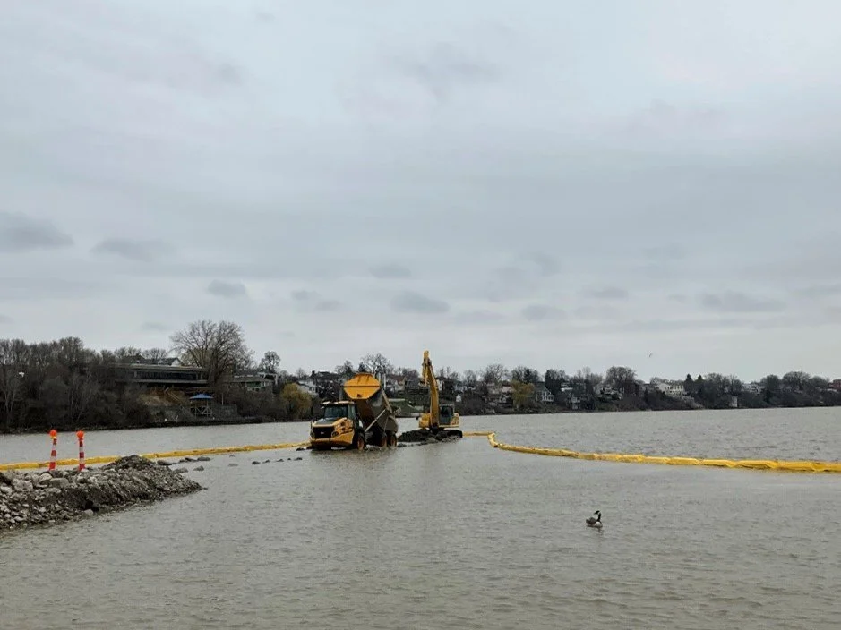
Gradel dredging the channel between Clark Island and the downstream end of Delaware/Horseshoe Island; facing east.
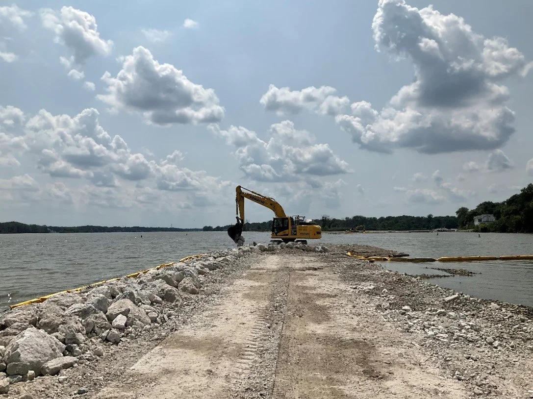
JULY 2025 - Mark Haynes Construction’s (MHC) landscaper, GEI, continued installing native plants and managing invasive species at Clark and Delaware/Horseshoe Islands, with work expected to continue through fall 2025. MHC also installed hazard signage, while the city of Toledo placed seasonal buoys near Clark Island to warn boaters of shallow rocks. Temporary access causeways were removed, and river bottoms restored, fully reopening boater access in both areas. MHC’s subcontractor, Geo. Gradel Co., plans to begin dredging the channel from Walbridge Park Boat Launch to the main river channel in late July, continuing through fall 2025 to support future operations and public boat access. Stone Environmental completed mussel relocation in the dredging area July 3–8. As noted previously, earthwork at the islands is substantially complete.

A hazard sign along the perimeter berm/revetment at Clark Island; facing northeast.
JUNE 2025 - Mark Haynes Construction’s (MHC’s) landscaper, GEI, continued installing native plants at Clark and Delaware/Horseshoe Islands. GEI also continued to treat/manage invasive plant species at Delaware/Horseshoe Islands. Plantings and treatment/management of invasive plant species are anticipated to continue through fall 2025. MHC started to install hazard signage at Clark and Delaware/Horseshoe Islands to warn boaters of shallow rocks. MHC also continued to remove the temporary access causeways and restore the river bottom in these areas to pre-construction conditions. Boater access is restored in the Delaware/Horseshoe access causeway area and is expected to be restored in the Clark Island access causeway area by the end of June 2025. In the interim, boaters using the Walbridge Park Boat Launch should continue to follow the downstream main channel access instructions. As stated in the previous update, earthwork activities are substantially complete at Clark and Delaware/Horseshoe Islands.
Overview of Clark Island; facing southwest.
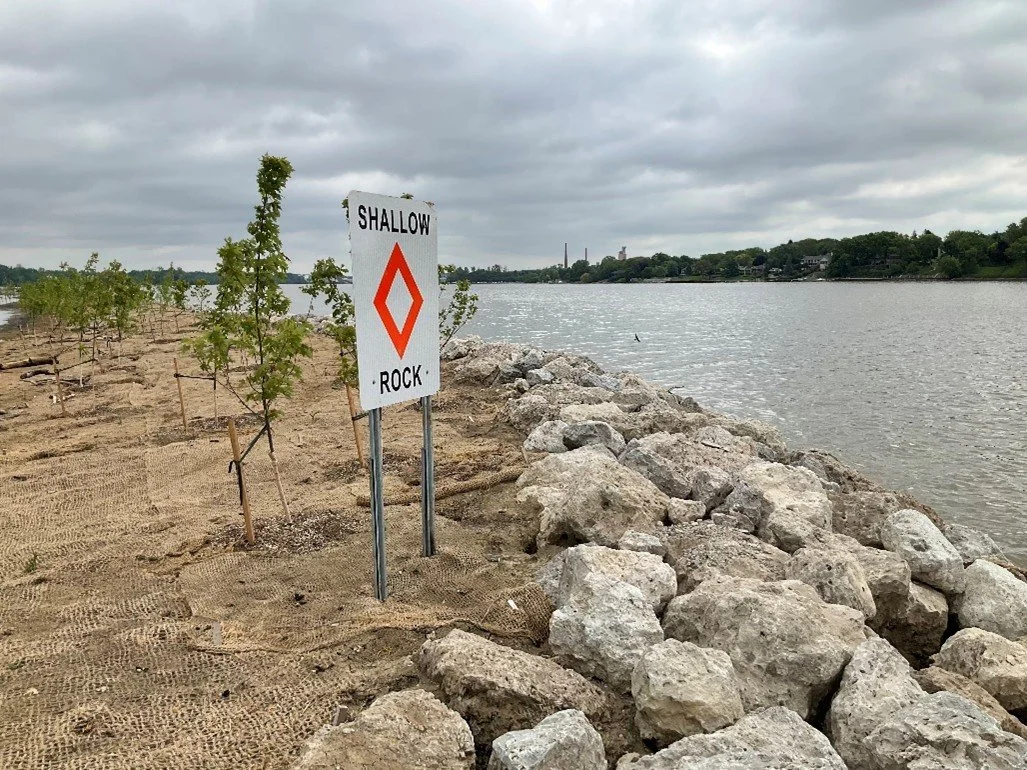
A hazard sign along the perimeter berm/revetment at Clark Island; facing northeast.
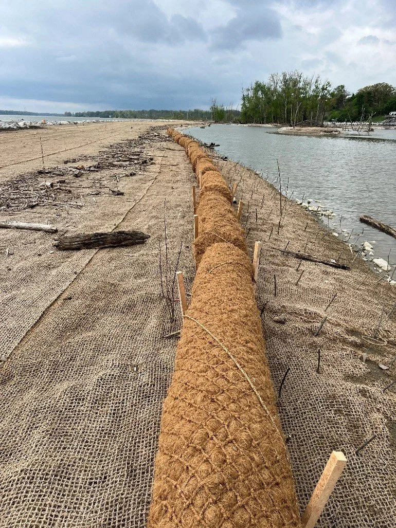
NOVEMBER 2024 - Mark Haynes Construction (MHC) continues to construct the perimeter rock berm/revetment structures at Clark and Delaware/Horseshoe Islands and backfill wetland areas. They finished dredging the coves at Delaware/Horseshoe Islands to create varying depths as well as placement of a variety of gravel and other bottom substrate to enhance fish and macroinvertebrate habitat at Delaware/Horseshoe Islands. MHC continues to install coir matting and coir logs for erosion protection and MHC’s landscaper, GEI Consultants, Inc. (GEI), continues to treat/manage invasive plant species and seed and install native plants and trees at Clark and Delaware/Horseshoe Islands.

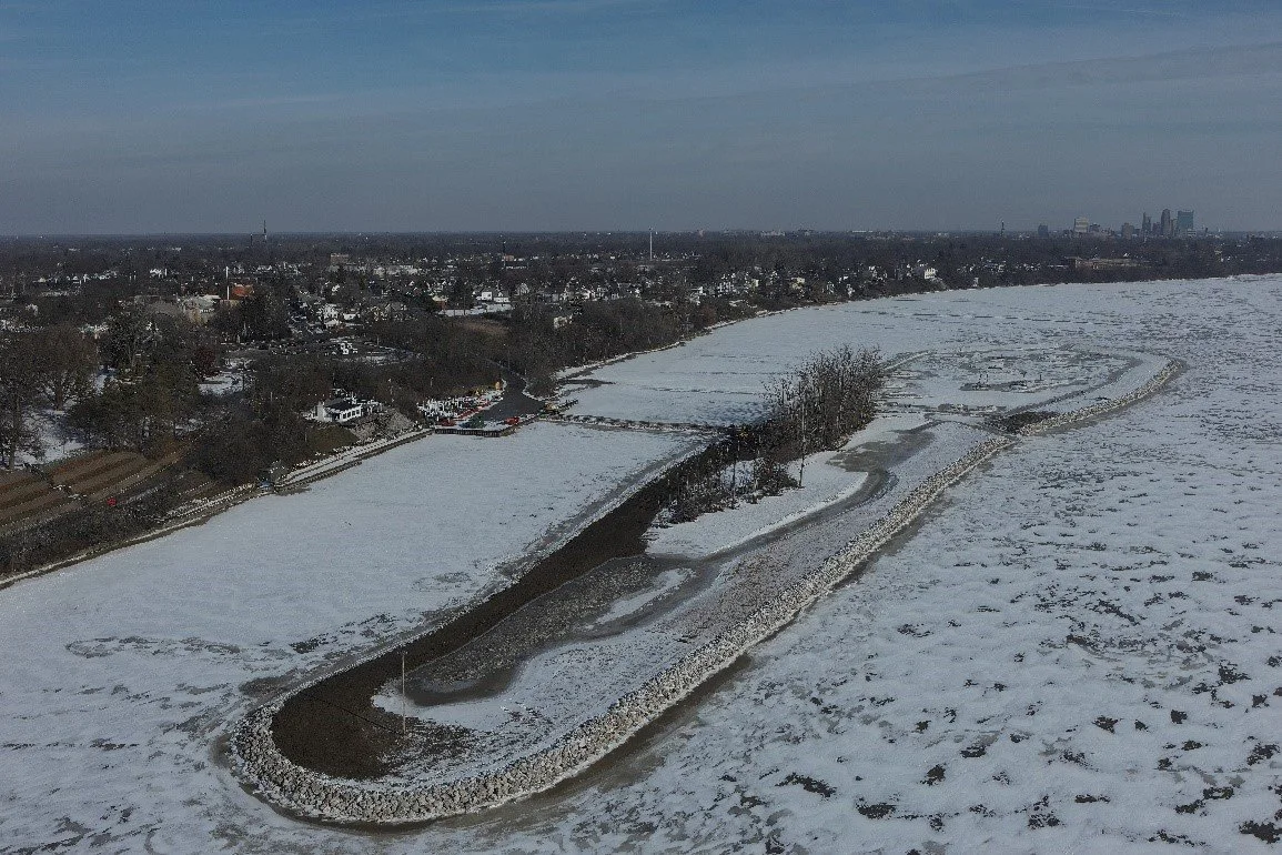
Overview of Clark Island; facing southwest.
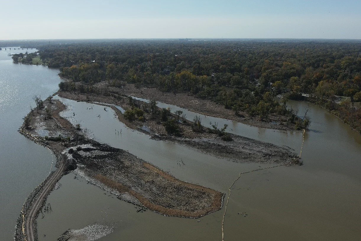
Overview of Delaware/Horseshoe Islands; facing southwest.
OCTOBER 2024 - Mark Haynes Construction (MHC) is constructing perimeter rock berms and backfilling wetlands at Clark and Delaware/Horseshoe Islands. They are dredging the coves to create varied depths for habitat, placing gravel and substrate to enhance fish and macroinvertebrate habitats, and removing unused access routes. MHC has begun installing coir matting and logs for erosion protection. Meanwhile, GEI Consultants, Inc. is managing invasive plant species and seeding native plants at Delaware/Horseshoe Islands.
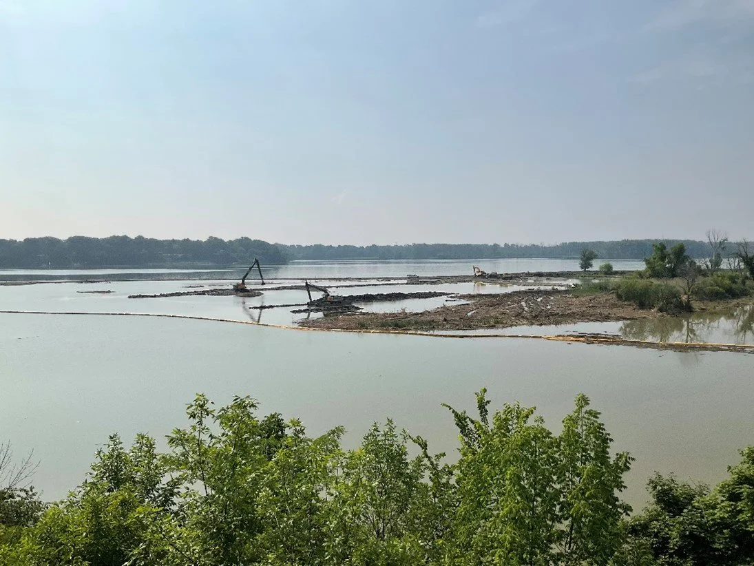
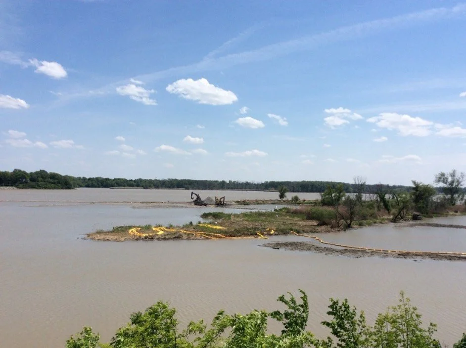
JULY 2024 - Mark Haynes Construction (MHC) continues to construct the perimeter rock berm/revetment structures at Clark and Delaware/Horseshoe Islands and backfilling wetland areas. They also continue to dredge the coves at Delaware/Horseshoe Islands and started to dredge the deep water pools at Clark Island to create varying depths that will provide habitat at different water levels. They continue to construct small islands and install stone and wood structures in the open backwater areas and other locations at Clark and Delaware/Horseshoe Islands to provide habitat while slowing down water flows and promoting sediment settlement. MHC started to place a variety of gravel and other bottom substrate to enhance fish and macroinvertebrate habitat at Delaware/Horseshoe Island. They continue to remove certain temporary access routes and staging areas once they are no longer needed.

Overview of Clark Island; facing northeast.
Overview of Delaware/Horseshoe Islands; facing southeast.
Overview of the downstream end of Delaware/Horseshoe Islands; facing southwest.
Excavators removing portions of the Delaware/Horseshoe Island temporary access causeway; facing northwest.
JUNE 2024 - Mark Haynes Construction (MHC) continues to construct the perimeter rock berm/revetment structures at Clark and Delaware/Horseshoe Islands and backfilling wetland areas. They also continue to dredge the coves at Delaware/Horseshoe Islands to create varying depths that will provide habitat at different water levels. They started to construct small islands and install stone and wood structures in the open backwater areas at Clark and Delaware/Horseshoe Islands to provide habitat while slowing down water flows and promoting sediment settlement. In addition, MHC started removing certain temporary access routes and staging areas once they were no longer needed.
Overview of a small island with woody habitat structures within the open backwater area at Clark Island; facing northwest.

Excavator dredging the east cove of Delaware/Horseshoe Islands; facing northwest.
Seeding a small island within the open backwater area at Clark Island; facing southeast.
Installing coir matting on the eastern island at Delaware/Horseshoe Island; facing north
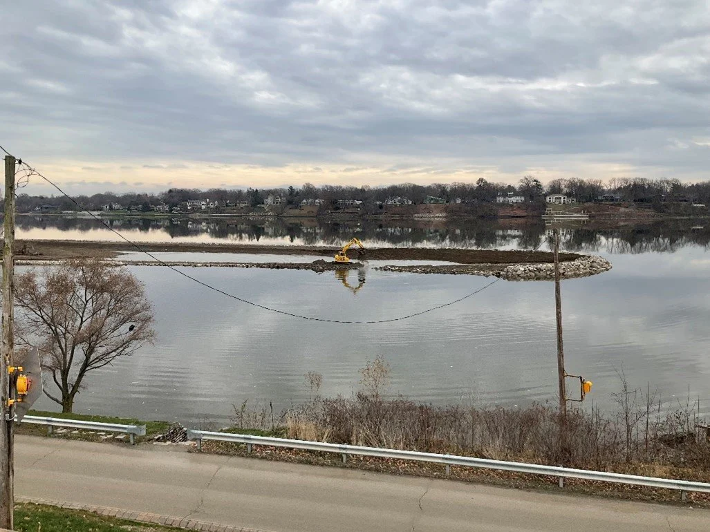
MAY 2024 - Mark Haynes Construction (MHC) is continuing to construct the perimeter rock berm/revetment structures at Clark and Delaware/Horseshoe Islands and backfilling wetland areas. They are also continuing to dredge the coves at Delaware/Horseshoe Islands to create varying depths that will provide habitat at different water levels. MHC removed a portion of the temporary access causeway at Delaware/Horseshoe Islands to provide access to the main river channel for the Maumee River Yacht Club and installed a temporary bridge across this opening to maintain access for equipment and materials on an as-needed basis.

Overview of the island perimeter berm/revetment at Clark Island; facing northeast.
Temporary bridge for equipment/material access across the opening in the temporary access causeway on an as-needed basis at Delaware/Horseshoe Islands; facing northwest.
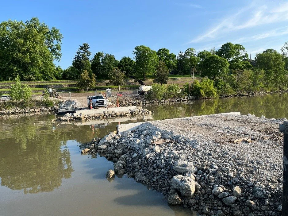
Pavement repair activities at the public boat launch parking lot; facing south.

Overview of the upstream end of Clark Island; facing southeast.

Overview of the native vegetation along the eastern island at Delaware/Horseshoe Island; facing southwest.
Overview of the downstream end of Delaware/Horseshoe Islands; facing southwest.
Excavator placing rock for the island perimeter berm/revetment at the downstream end of Delaware/Horseshoe Island; facing northeast.
Check back each month for new updates!
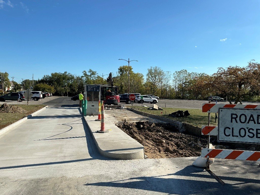
OCTOBER 2025 - Mark Haynes Construction (MHC) landscaper, GEI, installed native plants and continued invasive species management at Clark and Delaware/Horseshoe Islands. Srokowski Construction completed concrete repairs at the public boat launch entrance, and Geo. Gradel Co. dredged the channel from Walbridge Park Boat Launch to the main river channel, supporting future operations and boat access between the restored islands. Work is substantially complete, with invasive species management and plant maintenance expected through 2026.

Removing existing concrete at the parking lot entrance for the public boat launch; facing south.
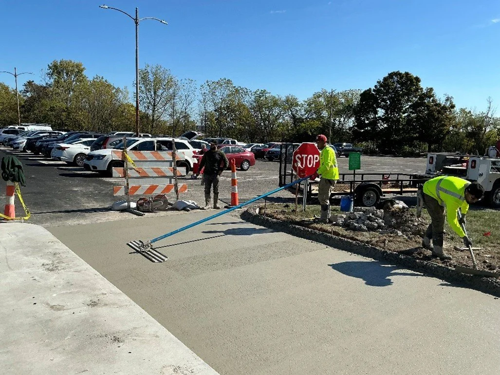
Leveling the concrete at the parking lot entrance for the public boat launch; facing east.
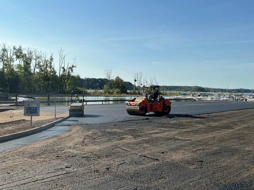
SEPTEMBER 2025 - Mark Haynes Construction’s (MHC) landscaper, GEI, continued planting native species and managing invasive plants at Clark and Delaware/Horseshoe Islands, with work expected to continue through fall 2025. MHC subcontractor Gerken Paving completed asphalt repairs at Walbridge Park and the public boat launch, with striping and concrete work wrapping up soon. Geo. Gradel Co. continued dredging the channel from the boat launch to the main river, supporting future maintenance and boat access; this work will also continue through fall 2025. The project is largely complete, and a ribbon-cutting ceremony was held at Walbridge Park on September 15 to celebrate.

Overview of Clark Island; facing southwest.

Gradel dredging the channel between Clark Island and the public boat launch; facing east.

Overview of the downstream end of Clark Island and removal of the temporary access causeway; facing northeast.

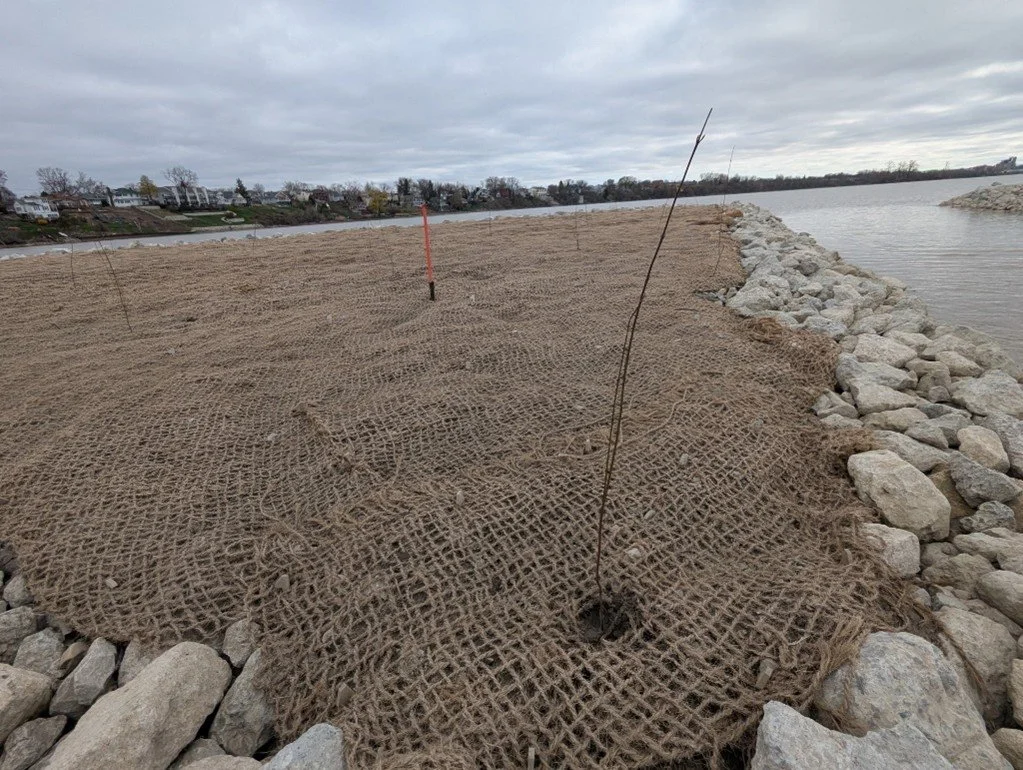
MAY 2025 - Mark Haynes Construction’s (MHC’s) landscaper, GEI, continued installing native plants at Clark Island. MHC finished installing coir logs for the shoreline protection at Clark Island and the GLRI portion of Delaware/Horseshoe Island. They also continued to remove the temporary access causeways. Boater access is restored in the Delaware/Horseshoe access causeway area and is expected to be restored in the Clark Island access causeway area within the month. In the interim, boaters using the Walbridge Park Boat Launch should continue to follow the downstream main channel access instructions. As stated in the previous update, earthwork activities are substantially complete at Clark and Delaware/Horseshoe Islands.

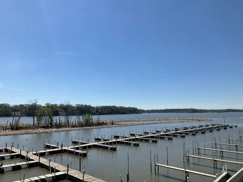
Overview of Delaware/Horseshoe Island; facing southeast.

Overview of live stakes at Clark Island; facing south.
APRIL 2025 - Mark Haynes Construction’s landscaper, GEI, continued seeding and installing native plants and trees at Clark and Delaware/Horseshoe Islands. As stated in the previous update, earthwork activities are substantially complete at Clark and Delaware/Horseshoe Islands.
Overview of Clark Island; facing southwest
MARCH 2025 - Mark Haynes Construction’s (MHC’s) landscaper, GEI, is waiting for more favorable weather conditions and will continue the final seeding/planting work in the spring. As stated in the previous update, earthwork activities are substantially complete at Clark and Delaware/Horseshoe Islands.
Overview of Clark Island; facing southwest
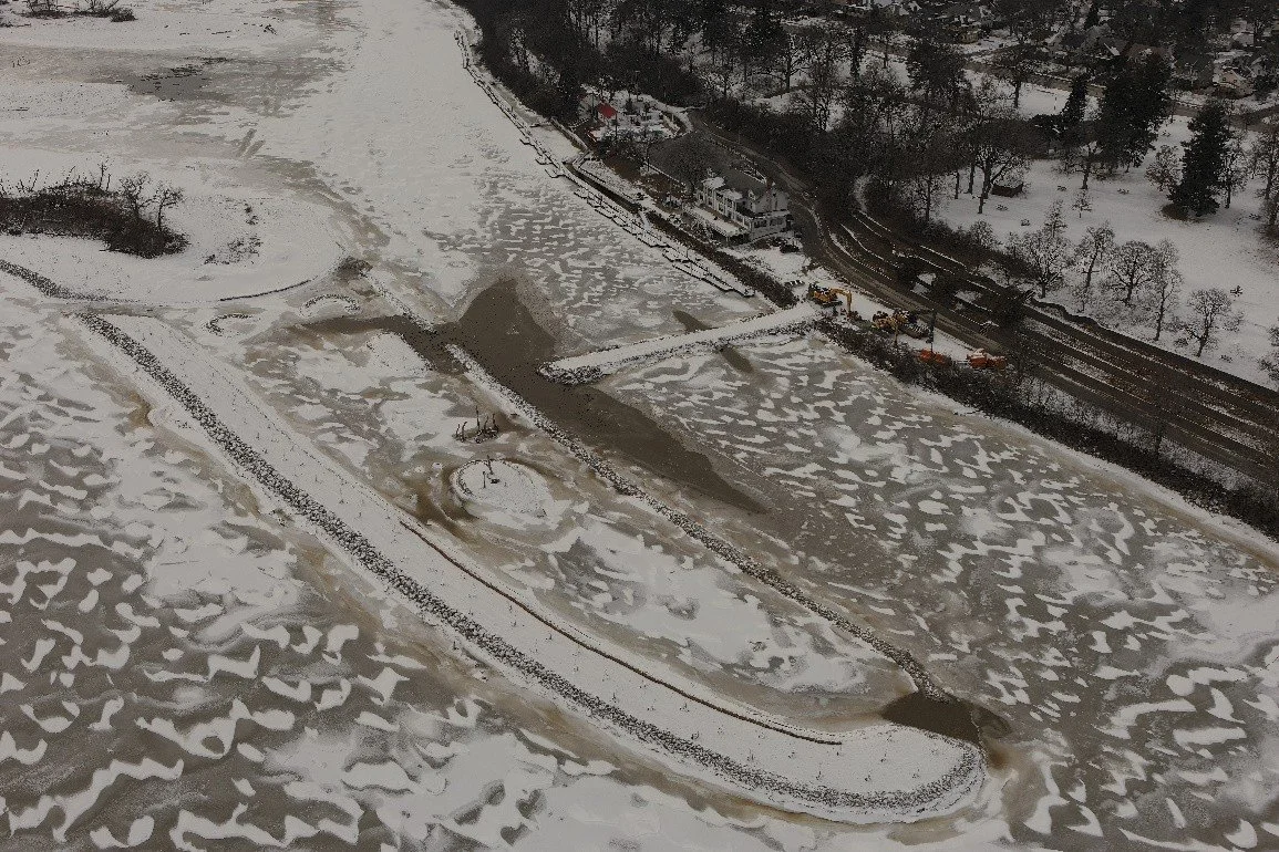
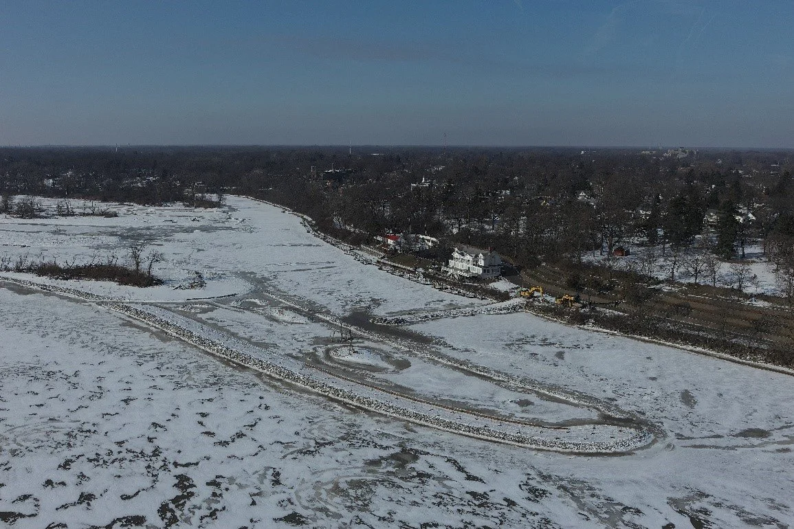
FEBRUARY 2025 - Mark Haynes Construction (MHC) completed construction of the perimeter rock berm/revetment structures and backfilling of wetland areas at Clark and Delaware/Horseshoe Islands. In addition, they completed dredging of the deep water pools at Delaware/Horseshoe Islands to create varying depths that will provide habitat at different water levels. MHC continued to seed and install coir matting for erosion protection at Clark Island. Earthwork activities at Clark and Delaware/Horseshoe Islands are substantially complete and final seeding and planting work will be completed in the spring.
Overview of Clark Island; facing north.
Excavator removing portions of a temporary access route at Clark Island; facing northeast.
JANUARY 2025 - Mark Haynes Construction (MHC) continues to construct the perimeter rock berm/revetment structures at Clark and Delaware/Horseshoe Islands and backfill wetland areas. They also continue to dredge the deep-water pools at Delaware/Horseshoe Islands and completed the installation of wood structures in the open backwater area. MHC continues to install coir matting and coir logs for erosion protection at Delaware/Horseshoe Island and Clark Island and installed an osprey platform at the upstream end of Clark Island. MHC’s landscaper, GEI Consultants, Inc., continues to seed and install native plants and trees at Clark and Delaware/Horseshoe Islands.

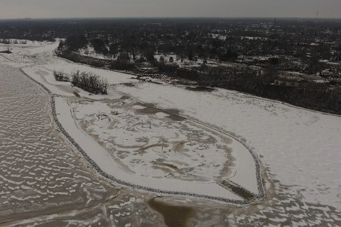
Overview of Clark Island; facing north.
Overview of the downstream end of Delaware/Horseshoe Island; facing southwest.
Overview of Delaware/Horseshoe Island; facing southwest.
Native vegetation along the eastern island at Delaware/Horseshoe Island.

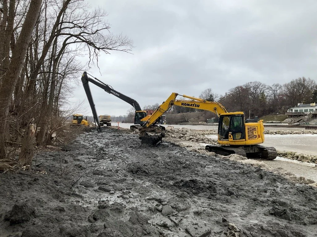
DECEMBER 2024 - Mark Haynes Construction (MHC) continues to construct the perimeter rock berm/revetment structures at Clark and Delaware/Horseshoe Islands and backfill wetland areas. They are also installing rock revetment structures along the open backwater area at the downstream end of Delaware/Horseshoe Island. They continue to remove certain temporary access routes and staging areas once they are no longer needed and are transporting excess material off-site. MHC continues to install coir matting for erosion protection at Clark Island. MHC’s landscaper, GEI Consultants, Inc. (GEI), continues to seed and install native plants and trees at Clark and Delaware/Horseshoe Islands.

Overview of Clark Island; facing southwest.

Overview of the downstream end of Delaware/Horseshoe Island; facing southwest.
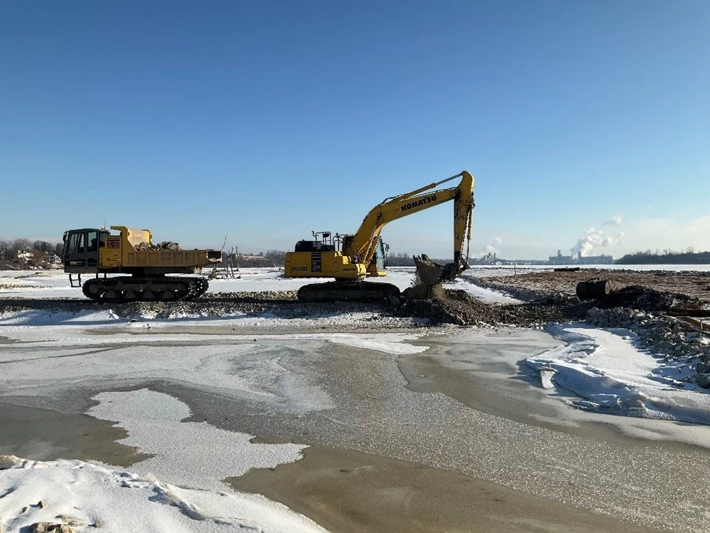
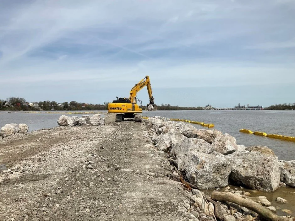
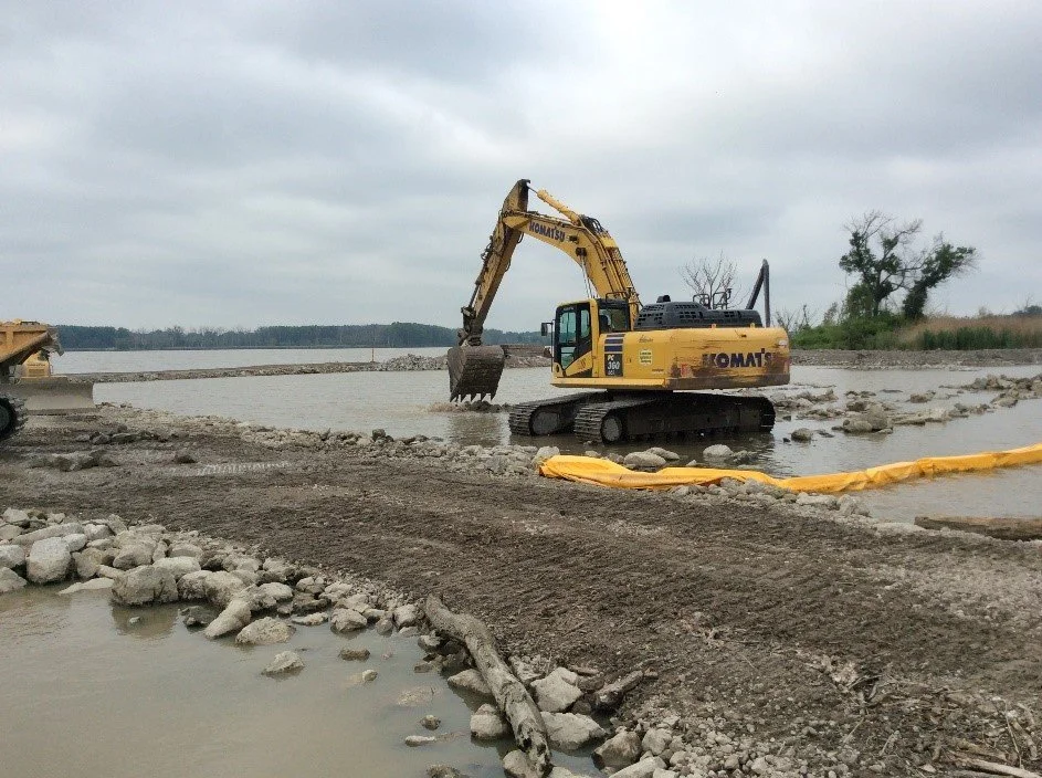
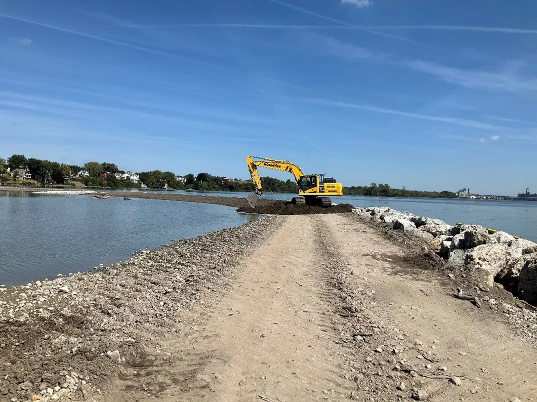
APRIL 2024 - Mark Haynes Construction is currently working on constructing the perimeter rock berm/revetment structures at Clark and Delaware/Horseshoe Islands and backfilling wetland areas. They are also dredging the coves at Delaware/Horseshoe Islands to create varying depths, providing habitat at different water levels.
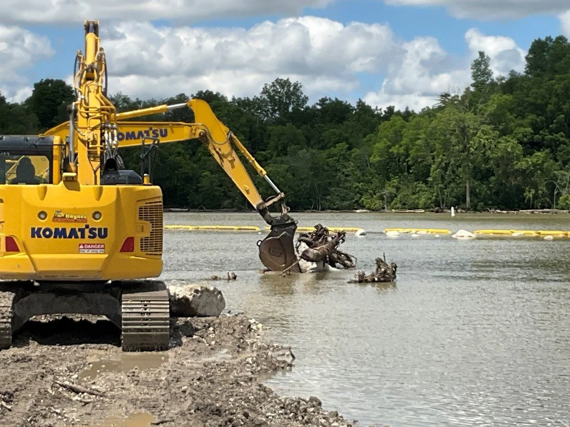
Excavator installing a woody habitat structure in the open backwater area at the downstream end of Delaware/Horseshoe Island; facing northeast.
Construction of the inner channel reef and placement of wetland fill at the upstream end of Clark Island; facing east.


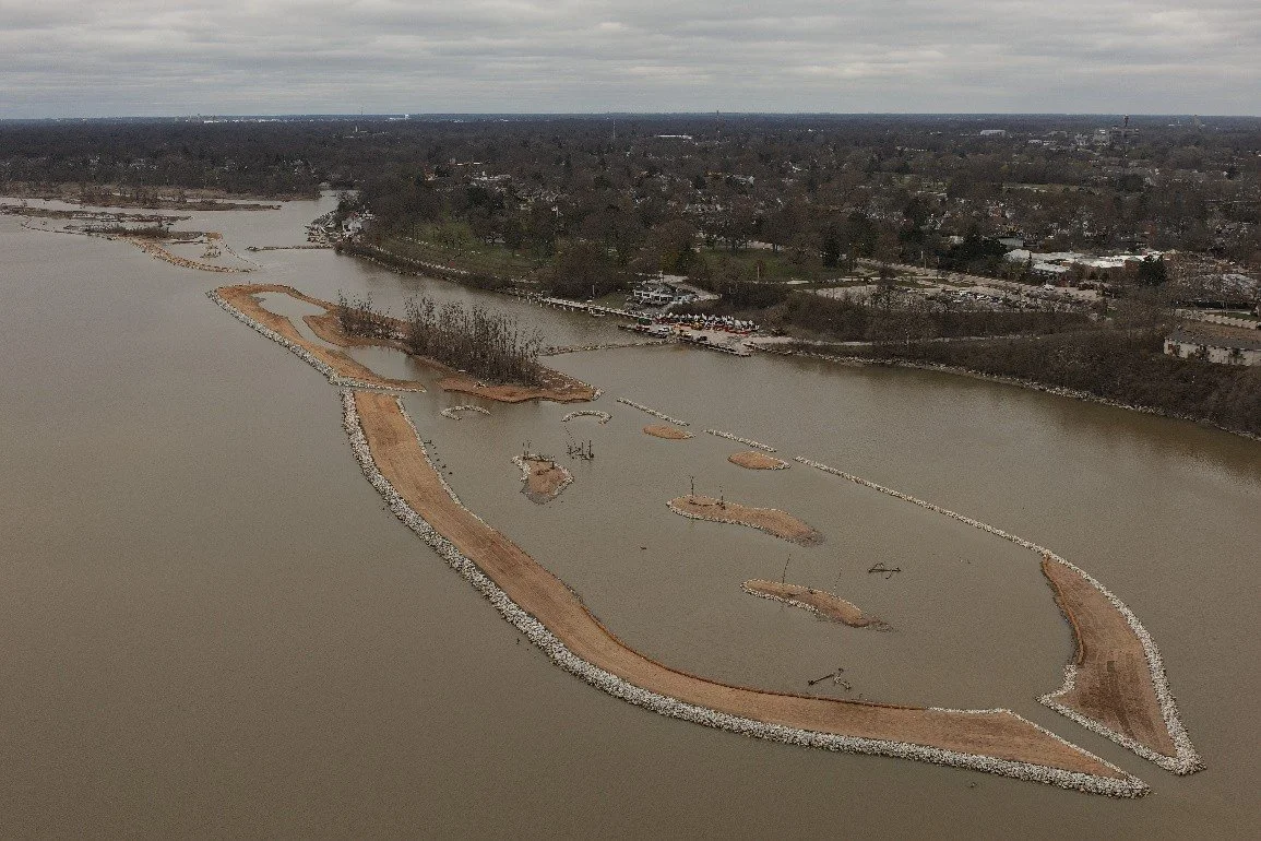
Overview of Delaware/Horseshoe Islands; facing southeast.
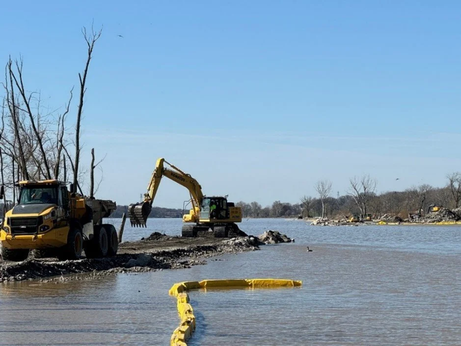
Excavator dredging the west cove of Delaware/Horseshoe Island; facing southeast.

Overview of the upstream end of Clark Island; facing southeast.
Excavators removing portions of the Delaware/Horseshoe Island temporary access causeway; facing northeast.

Overview of the downstream end of Delaware/Horseshoe Islands; facing southwest.
Downstream end of Delaware/Horseshoe Island; facing southwest.

Excavators placing and grading wetland fill at Clark Island; facing northwest.
Excavators placing and grading wetland fill; facing southwest.
Overview of the open backwater area at Clark Island; facing north.
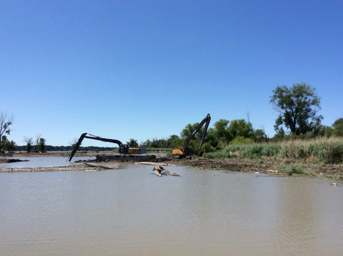
Excavators dredging the east cove of Delaware/Horseshoe Islands; facing south.
Overview of a stone structure within the open backwater area at Clark Island; facing north.

Dozer grading backfill material for wetland areas at Delaware/Horseshoe Islands; facing west.
Overview of Delaware/Horseshoe Islands; facing southeast.
Excavator constructing a small island within the open backwater area at Delaware/Horseshoe Islands; facing southeast.
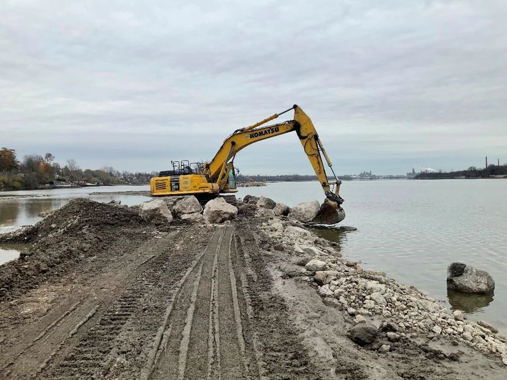
Excavator placing rock for the island perimeter berm/revetment at Clark Island; facing southwest.

Excavators installing a wood structure along the shoreline at Delaware/Horseshoe Island; facing south.
Excavator installing a woody habitat structure in the open backwater area at Clark Island; facing northeast.
Overview of a small island within the open backwater area at Delaware/Horseshoe Islands; facing south.
Excavator removing portions of the staging area at Clark Island; facing southeast.
Excavator placing rock for the island perimeter berm/revetment at Clark Island; facing northeast.

Pouring concrete for the parking lot entrance for the public boat launch; facing north.
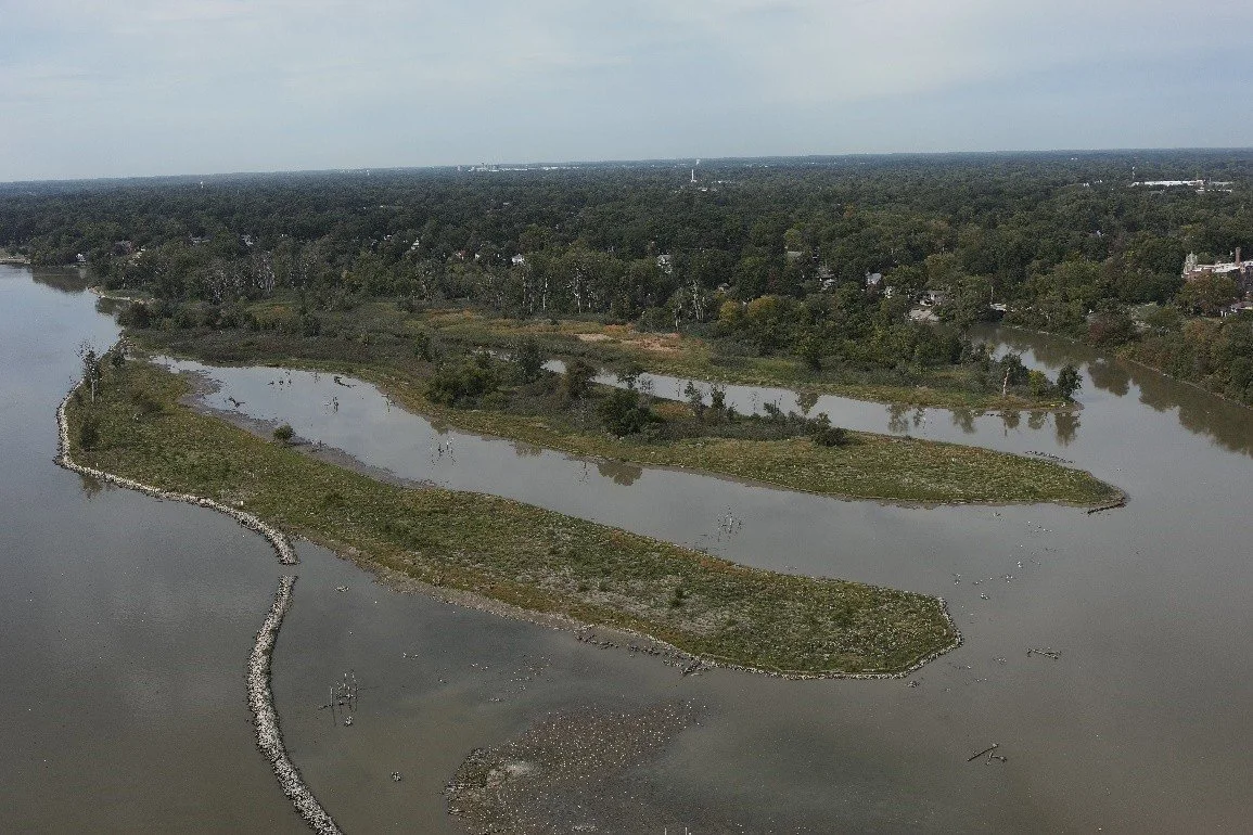
Overview of Delaware/Horseshoe Island; facing southwest.

Overview of completed pavement repair work on the road between the Toledo Sailing Club and the Maumee River Yacht Club; facing southwest.

Planting native vegetation on the eastern island at Delaware/Horseshoe Island; facing south.
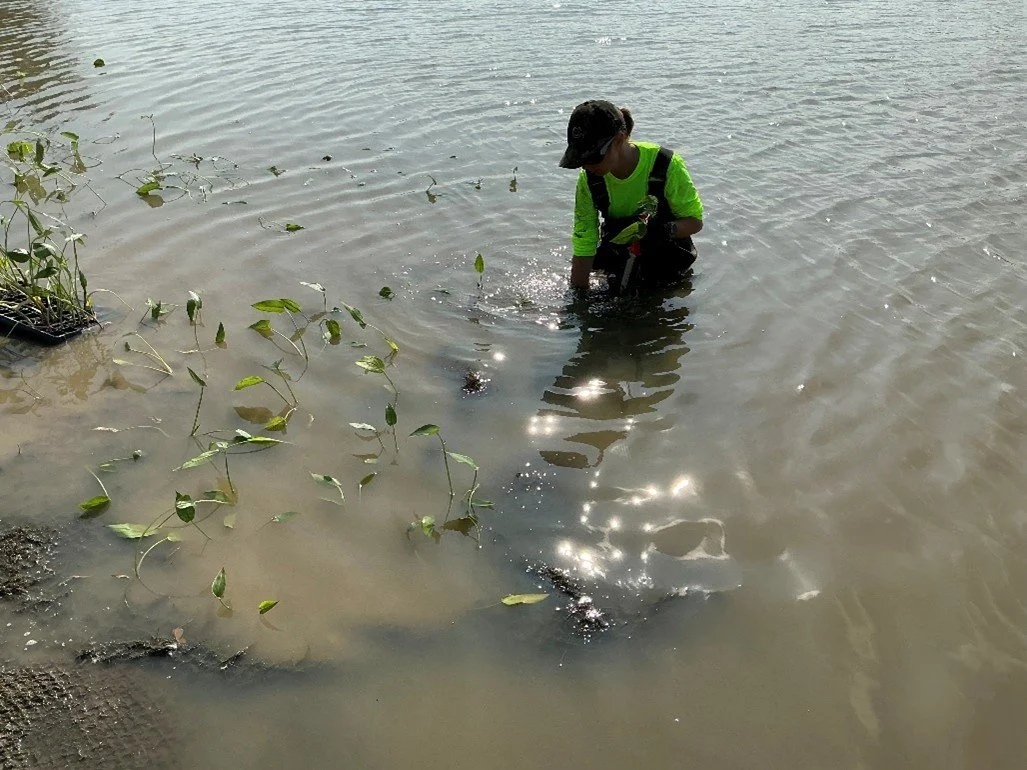
Planting native vegetation in the connector channel at Clark Island; facing northeast.

Overview of the native vegetation along the eastern island at Delaware/Horseshoe Island; facing northeast.

Overview of Delaware/Horseshoe Islands; facing southwest.

Planting native vegetation at Clark Island; facing west.
Overview of the coir logs and live stakes along the shoreline of the open backwater area at Clark Island; facing southwest.
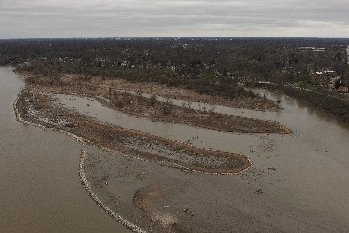
Overview of Delaware/Horseshoe Islands; facing southwest.

Overview of Delaware/Horseshoe Islands; facing southwest.

Overview of Delaware/Horseshoe Island; facing southwest.

Staking coir matting at Clark Island; facing north.

Overview of the installed osprey platform at Clark Island; facing southwest.

Overview of native plants and trees at the downstream end of Delaware/Horseshoe Island; facing northeast.

Excavator placing wetland fill at Clark Island; facing north.

Overview of interior revetment along the open backwater area at the downstream end of Delaware/Horseshoe Island; facing south.

Excavator grading topsoil at Clark Island; facing southwest.
Planting trees on the eastern island at Delaware/Horseshoe Island; facing southeast.

Opening in the temporary access causeway at Delaware/Horseshoe Islands to provide access to the main river channel for the Maumee River Yacht Club; facing northwest.
Placement of rock for the inner channel reef at Clark Island; facing northwest.
SEPTEMBER 2024 - Mark Haynes Construction (MHC) is actively constructing the perimeter rock berms/revetment structures at Clark and Delaware/Horseshoe Islands while backfilling wetland areas. They are also dredging the coves at Delaware/Horseshoe Islands to create varied depths for diverse aquatic habitats. MHC has completed the installation of stone and wood structures in the open backwater areas at Clark Island and is continuing this work at Delaware/Horseshoe Islands to enhance habitat, slow water flow, and promote sediment settlement. Meanwhile, GEI Consultants, Inc. (GEI), MHC’s landscaping partner, has begun managing invasive plant species at all the islands and planting native plants at Delaware/Horseshoe Islands.

Overview of Clark Island; facing northeast.

Overview of Delaware/Horseshoe Islands; facing south.
AUGUST 2024 - Mark Haynes Construction (MHC) continues to construct the perimeter rock berm/revetment structures while backfilling wetland areas at Clark and Delaware/Horseshoe Islands. The team is also dredging the coves at Delaware/Horseshoe Islands and the deep-water pools at Clark Island to create varying depths that will provide habitat at different water levels. In addition, MCH is constructing small islands and installing stone and wood structures in the open backwater areas and other locations at Clark and Delaware/Horseshoe Islands. MHC continues to place a variety of gravel and other bottom substrate to enhance fish and macroinvertebrate habitat at Delaware/Horseshoe Island.

Overview of Clark Island; facing southeast.

Overview of Delaware/Horseshoe Island; facing southeast.
Excavator placing rock for the island perimeter berm/revetment at Clark Island; facing northeast.
Treating invasive plant species at Delaware/Horseshoe Islands; facing southwest.

Excavator constructing a small island within the open backwater area at Clark Island; facing north.
Dozer grading wetland fill on the eastern island at Delaware/Horseshoe Islands; facing northeast.
Excavator placing and grading wetland fill at Clark Island; facing northeast.

Excavator placing a variety of gravel and other bottom substrate in the west cove at Delaware/Horseshoe Islands; facing west.
Overview of Clark Island; facing southeast.

Overview of Delaware/Horseshoe Islands; facing south.

Overview of the outlet at Clark Island; facing southwest.

Mowing and discing invasive plant species at Delaware/Horseshoe Islands; facing west.

Dozer grading wetland fill at Clark Island; facing west.

Overview of native plants at Delaware/Horseshoe Islands; facing southwest.